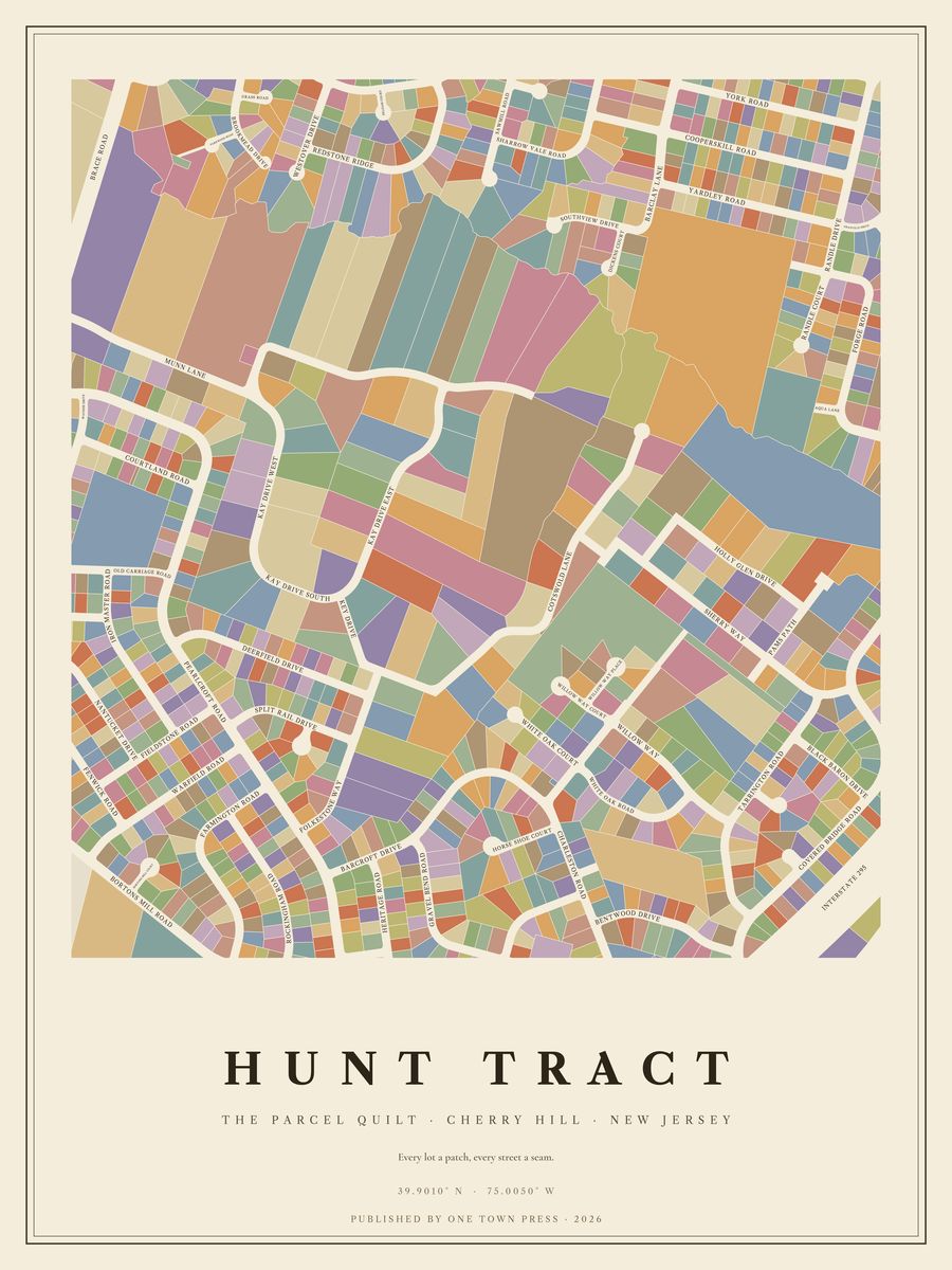
Tap the map to see it up close.
Cherry Hill · New Jersey
Tap the map to see it up close.
662 lots on Camden County’s parcel map, along 50 streets. Where the county records the year a home was built, they date from 1740 to 2022; 75% of them went up in the 1960s. The typical lot is about 0.30 acres; the largest is 11.8 acres.
Its streets: Pearl Croft Road, Tarrington Road, Barcroft Drive, Munn Lane, Deerfield Drive, Redstone Ridge, Iron Master Road, Cotswold Lane, Farmington Road, Heritage Road, Warfield Road, Sherry Way, Gravel Bend Road, Charleston Road, Bentwood Drive, Rockingham Road, Nantucket Drive, White Oak Road, Courtland Road, Split Rail Drive, Folkestone Way, Kay Drive East, Sawmill Road, Willow Way, Bortons Mill Road, Horse Shoe Court, Fenwick Road, Holly Glen Drive, Fieldstone Road, White Oak Court, Kay Drive West, Westover Drive, Willow Way Place, Black Baron Drive, Kay Drive South, Wayside Drive, Bortons Mill Court, Willow Way Court, Split Rail Court, Brookmead Drive, Old Carriage Road, Southview Drive, Pelham Court, Pelham Road, Covered Bridge Court, Kitty Hawk Road, Kay Drive, Parkwood Road, Tarrington Court, Fern Avenue.
Next door: Barclay Farm, Kresson Woods, Kingsway Village, Charleston Riding, Haddontowne, Ellisburg.
Your home on its own: the Lot, the Block, the Street →Back to Cherry Hill →